Interagency Access Pass
Tower Ski Trails
Get real time grooming updates, offline trail maps, and trail conditions with 
TOWER SKI TRAILS
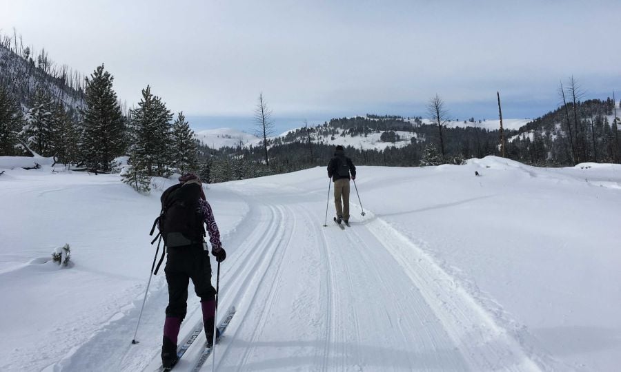
The Tower area offers excellent machine groomed trails for classic and skate skiing. For more info on specific trails, see map and trail descriptions below or download trail descriptions and trail map. For up to date trail conditions call (307-344-5699) or stop by our ski shop.

LOST LAKE TRAIL
4 miles (6.4 km), more difficult
This trail does not follow the maintained summer hiking trail after Lost Creek. Watch closely for trail markers as the route can be difficult to find. Visitors can park in the large pull out 100 yards east of Petrified Tree entrance on the Grand Loop road. Ski south on the Petrified Tree road, then through a narrow open valley up to Lost Lake. Follow the north shore to the head of the lake, approximately 1.5 miles (2.4 km), then travel through intermittent forest and meadows. After 2.5 miles (4 km) and a short steep descent use extreme caution crossing the foot bridge over Lost Creek Falls. Rolling terrain for 1.5 miles (2.4 km), then a steep descent to Calcite Springs Overlook connecting to the Tower Falls Trail, 1.4 miles (2.25 km) from Tower Junction. Note: Trail ends at Tower Falls parking area, car shuttle or hitch hiking will be necessary.
TOWER FALL TRAIL (GROOMED)
2.5 miles one way (4 km), easiest
Begin at the parking area just southeast of Tower Junction. The trail follows the unplowed Tower-Canyon road up a gradual slope past Calcite Springs Overlook to Tower Fall. Great views of the Yellowstone River Canyon, occasional bison, bighorn sheep and bald eagles. Note: Walkers/snowshoers please use far left lane. Groomed for skate and classic skiing
BLACKTRAIL PLATEAU TRAIL (GROOMED)
8 miles (12.8 km), easiest to more difficult
This trail may be skied from either end. Begin 8 miles (13 km) east of Mammoth Hot Springs at a parking area across the road from a self-guiding trail, or at a
service road approximately 1 mile (1.6 km) farther east (see map). The trail gradually climbs 900 feet (274 m) in 6 miles (9.7 km) through open meadows to
“The Cut” – the highest point on the trail at 7571 feet. From here the trail descends 2 miles (3.2 km) down a moderate grade through a spruce-fir forest to rejoin
the Mammoth-Tower Road 1.4 miles (2.25 km) from Tower Junction. Broad vistas, elk, deer, coyotes, and occasionally bison may be seen. Note: An out and back ski is a good choice if you do not have a car shuttle. “The Cut” is a good turn around spot.
CHITTENDEN LOOP TRAIL
5.3 miles (8.3 km), easiest to more difficult
The Trail begins at Tower Fall which is 2.5 miles (4 km) from Tower Junction. The trail is easiest if you climb the more difficult section at the beginning of
the loop by heading to the right through Tower Fall Campground. More experienced skiers may wish to ski the loop in the opposite direction; however, the
“more difficult” portion of the loop can be quite fast if snow is packed. The trail continues through dense lodgepole pine returning to the unplowed Tower Fall road. From here the route goes approximately 3 miles (4.8 km) back to Tower Fall. Good views of Mt. Washburn are possible. Note: This is a 10 mile trail in total.